It was probably not the ideal day to go touring but our time here at Porrungurup will go very fast so we have to make the best of the time that we have left. We wanted to do the tourist drive of Stirling National Park that is around 40kms from Porrongurup and if we followed the full circuit (that we like to do) we would end up at Mt. Barker. We missed out on the Mount Barker Lookout when we stayed there last week due to very poor weather so we thought it would be a good opportunity to re-visit this landmark.
We set sail just after 9am and the weather was once again very ordinary with lots of intermittent showers. And have I told you how cold it is! Just four degrees again this morning. But not to be deterred we started heading down the road towards Stirling National Park.
The Stirling Range is the only range in the south west of Western Australia but it is very impressive rising to more than a 1000m above sea level. The range is roughly 65km long and 16km wide so it is really quite small. It is home to an abundance of wildflowers in the spring so I will be on the lookout for them.
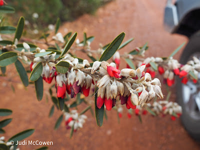
It is not long before we see the souring mountains rising in front of us and just a short distance further we turn onto a gravel road. The Scenic Drive is around 42kms in length and we pass some truly spectacular mountains in between the cloud cover that seems to descend on the top of the mountains very quickly. We stopped quite a few times when we find a view that is stunning or when I spot a different wildflower on the side of the road.
The road branches off many times towards different walks that you can do throughout the park. Most are fairly challenging but if the weather improves we would like to try and challenge ourselves to Bluff Knoll. The photographs I have seen are truly spectacular.
We stopped at Central and Western Lookouts but it started to rain very heavy at Central so we turned back along the path. It was a 400m walk to the top of a hill but in the rain it was very slippery. We were lucky enough to have a break in the weather at Western lookout and managed to get a selfie.The forty two kilometres took us almost two hours with lots of stops along the way. The gravel road was step in parts and quite slippery after the rain so we took it very steady. We hit a peak altitude of just over 400m on our drive through the range.
It was a pleasant drive through the wheat fields and paddocks dotted with sheep to arrive back in Mt Barker. A quick stop at IGA before we headed to the Mount Barker Lookout that boasts the highest free standing tower in the southern hemisphere. It is a broadcast tower and rises to a height of 184 metres. There is a well appointed lookout and a very new walk trail that takes you in a circle around Mt. Barker. Both places offer wonderful views but once again the clouds (and rain) crossed our path so we couldn't appreciate it as much as you would on a bright sunny day. Apparently on a clear day you can see all the way to Albany.
Our last stop before we arrived home was to catch a glimpse of the Porrongurups from a different aspect. This is where we hiked a couple of days ago to the Granite Skywalk.With luck we will have a little less rain tomorrow so we intend to do a walk through the Porrungurups. It is called the Pass and is just a two kilometre walk. We don't want to walk too far in case it rains heavily and we get caught in the middle of nowhere 😩


No comments:
Post a Comment